SUPERVISION
CON DRONES
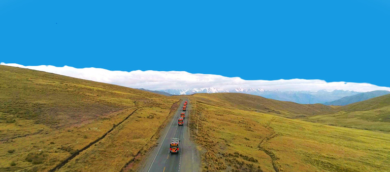
CONTROL DE PROYECTOS
JC Ingeniería y Construcción
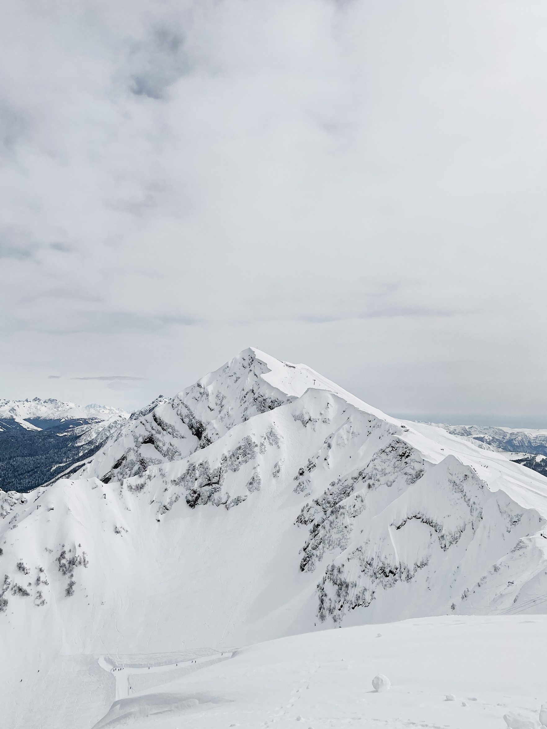
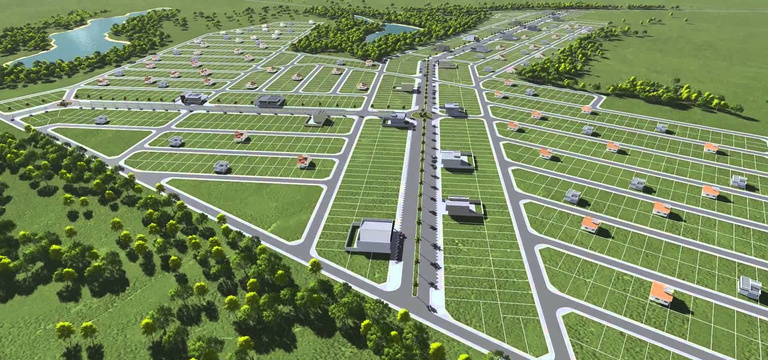
TOPOGRAFÍA
CON DRONES
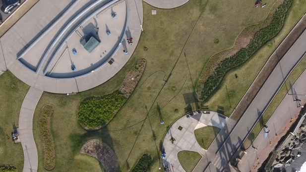
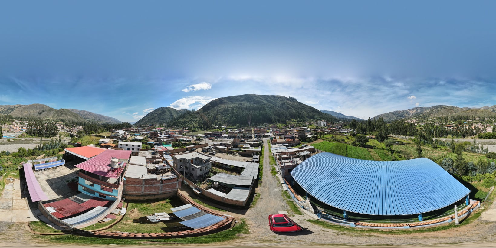
FOTOGRAMETRÍA A UN CLICK
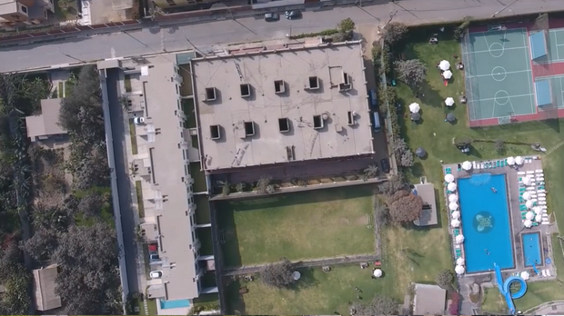
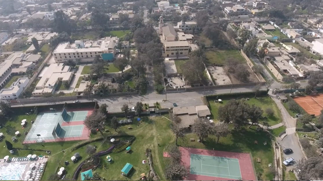
FOTOGRAFIAS CON DRONES
EL MUNDO DESDE ARRIBA
JC Ingeniería y Construcción
FOTOGRAFIAS CON DRONES
SOMOS UNA EMPRESA PERUANA QUE BRINDA SERVICIOS EN EL ÁREA DE LA GEOMATICA.
Especialistas en el área de Topografía - Geodesia, Fotogrametría en los sectores Civiles y Mineros.
Proyectos Públicos y Privados.
Elaboración de Expedientes Técnicos.
Alquiler de equipos topográficos en general.
FOTOGRAFÍA:
FOTOS Y VIDEOS CON DRON
Llamar al +51 964934670
WhatsApp: 965 486 438
“Los drones son una herramienta fantástica para la construcción y la ingeniería. Nos permiten hacer cosas que antes no eran posibles, como tomar imágenes aéreas de alta resolución en lugares inaccesibles y crear mapas 3D precisos en tiempo real. Esto significa que podemos tomar decisiones más informadas y precisas sobre cómo planificar y ejecutar proyectos de construcción.”
Como Podemos Ayudarte
SERVICIO DE TOPOGRAFÍA EN GENERAL
ALQUILER DE EQUIPOS TOPOGRAFICOS.
Estación Total
Gps Diferencial GNSS
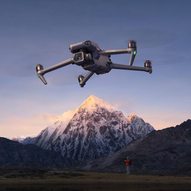
Drone Mini 4pro 5k
Drone MAVIC 3E - PHAMTOM 4Pro V2.0
Nivel de Ingeniero
Ecosondas
Levantamientos con GPS en modo RTK
Certificación de puntos Geodesicos.
Fotogrametría de concesiones Mineras.
Pilotos con certificación por el MTC-DGAC
FOTOGRAFIA & VIDEO CON DRON
Placa de Bronce
Puntos Gedesicos
Dron Mavic 3 Enterprise para Fotogrametría
GEODESIA
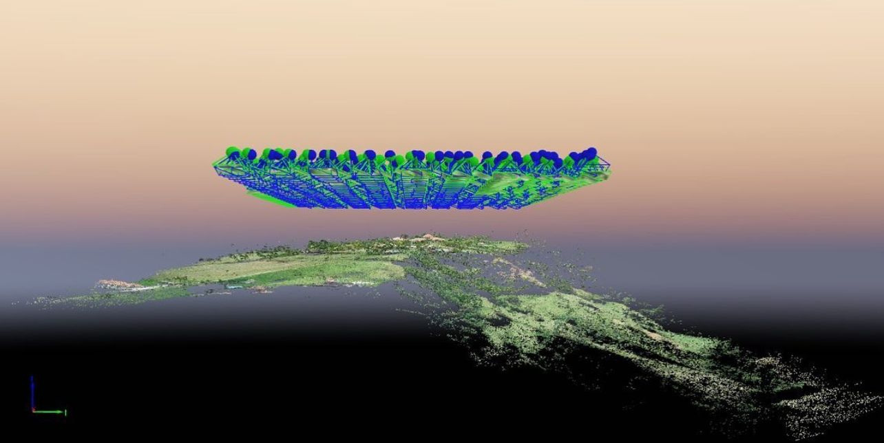
FOTOGRAMETRÍA
Servicio de vuelos con Drone - Fotografía & Filmación - Drone En Formato, Full HD, UHD
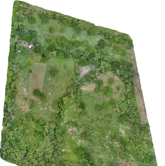
Ortofoto
Tus proyectos Civiles y Mineros con
Fotogrametría
Drone Mavic 3E
EL mejor Drone del Mercado para
TOPOGRAFÍA- FOTOGRAMETRÍA
lo tenemos a tu disposición
Vuelos con PHANTOM 4Pro
Fotogrametría


Servicios de FOTOGRAFÍA & VIDEO con DRONE Calidad 4K
FOTOGRAFÍA Y VIDEO AÉREO PARA TERRENOS, CASAS Y EVENTOS.
Duración: 10 min de video en varios clips + fotografías de distintos ángulos.

Ventajas del Servicio:
Perspectiva Única: Las fotos y videos aéreas capturan las dimensiones y características de la propiedad o evento de manera que las fotos tradicionales no pueden.

Inmobiliarias:

Potencia la presentación de tu propiedad para Venta con ubicaciones desde el aire.
Captura en videos y fotos referencias para mayor información.
CONTACTO:
MIS REDES:


E MAIL:
sleon.cip@gmail.com
E MAIL:
+51 964934670
ubicación:
Huaraz - Ancash - Perú
JC Ingeniería y Construcción